A
number of texts have survived which list many places
and their relation to each other. Some of these suggest
routes as they give the distances between towns without
detailing the intermediate countryside like the other
texts, and there were known routes between these places
in the 1700‘s, sometimes earlier.
In
this section the lists of distances suggestive of routes
are given and an attempt made to identify the course
they may have taken. Where relevant, links are shown
to river crossings and placenames that may be associated
with a route, as well as any supplementary evidence.
As several of the routes cross over to the Upper Clydesdale
sheet, both Upper and Lower Clydesdale are considered
together.
The
texts as well as details of their authorship can be
viewed at the NLS
website and are also in McFarlane’s Geographical Collections.
Some of the distances are dated 1644 and 1646 and were
probably obtained by Robert Gordon as part of his preparatory
work for the Blaeu atlas but others refer directly to
Pont having recorded them.
Distances
of relevance to the Clydesdale sheets are as follows:
Note
of Lennox and Sterlingshyr gotten from Gentlemen of
the countrey 15 May 1644.
Noates and Memoirs drawn furth of Mr Timothey Pont his
papers
Divers distances (McFarlane, Vol.2, p586)
Further Divers distances
Notes sent out the south to me in February 1646.
The Routes
Click on map to enlarge
Based on 1/4"
OS map of 1936. With thanks to Ordnance Survey
Small
map (100K)
Note of Lennox and Sterlingshyr gotten
from Gentlemen of the countrey 15 May 1644.
Kirkintilloch
- Glasgow 6 miles
Route Trending NNE via Balornock, Auchinairn,
Loch Grog to Kirkintilloch.
Evidence Included in lists of distances. Route
shown on map and bridge at Luggie
Water in Kirkintilloch.
Glasgow - Partick
2
Route Roy’s maps suggests that the road went
closer to the river, approximately on the line of the
Clydeside Expressway as far as the location of Old Partick
Bridge. It is thought that this was on the early route
to Dumbarton.
Evidence Included in lists of distances. Old
Partick Bridge.
Kirkintilloch - Partick
at Kelvin Mouth 8
The distance of 8 miles suggests the route was via Glasgow.
Monkland Kirk - Glasgow
8
Route Evidence for the route is poor. Roy has a
route through Parkhead and Shettleston where it went up
to Barlanark and over to near Bargeddie and then Coatbridge.
It is a bit surprising that he shows nothing on the more
direct line through Ballieston and he has nothing going
to Old Monkland where the Kirk was (NS7163). In this respect
the crossing Pont shows at Bargeddie (No.13) could make
sense as it would allow access to the Kirk if the initial
stages of Pont‘s route were the same as Roy as far as
Bargeddie. He may also have had the more direct line from
Shettleston through Baillieston to Bargeddie. Having said
that, however, we cannot assume the road went directly
to Monklands Kirk -his route may just have been close
to Roy’s right into Coatbridge where there was a road
of ľ mile leading due south to the Kirk.
Evidence Included in lists of distances. The more
northerly bridge over the Molendinar
(Nos.6&7) would have given easy access to the Parkhead/Shettleston
area and the crossing of the Tollcross
Burn may have been involved. The Bargeddie
crossing would have allowed an easy approach to the Kirk
but as noted above there are uncertainties about this
route.
Notes and Memoirs drawn furth of Mr
Timothey Pont his papers. Divers distances. See also
McFarlane, Vol.2, p586
Ayr - Lanark 24
miles - Newmils town is midway
Route Given T Reid’s (Fords,
Ferries, Floats and Bridges near Lanark, PSAS, Vol.47,
1912-13) mention of the Clydeholme ford and ferry
(near Kirkfieldbank close to Lanark) as having been
used from early times for travel (certainly in Pont’s
day) between Ayrshire and the Lothians the route from
Newmilns would have been up the Irvine Valley to Strathaven.
From there it probably went by the route shown on Roy
as leading to just north of Lesmahagow where there was
a bridge and then directly over to the ferry. The only
other possibilities are an unknown route between Strathaven
and Lanark (though still fairly direct) or along the
line of the Castledykes - Loudoun Hill Roman road which
the RCAHMS suggest crossed at the ford and then ran
about 1 km south of the Clyde until it crossed the Nethan
and then, close to Fence Farm (NS 807459), took up its
alignment with the well known stretch south of Stonehouse.
However, this route was badly decayed or scarcely recognisable
in many places and does not appear on Roy so does not
seem likely. The Strathaven to Lanark route went as
far as Sandford (A726) where it cut directly across
to Dykehead, followed the line of the A726 as far as
Woodhead and then ran directly to the bridge at Craig
head (No.9) (near Lesmahagow) then across what is now
open country to one km beyond Greenrig (NS 857422) from
where it ran up to the Clydeholme ferry with Nether
and Over Baithils nearby.
Evidence Included in lists of distances. Placenames
of Lochgait,
west of Drumclog and Sandford,
2 miles south-east of Strathaven. Bridge at Craighead.
Clydesholme
ford and ferry are known to have operated in Pont’s
day and to have been on an Ayr - Edinburgh route. The
only uncertainty is the exact route between Strathaven
and Lanark
Douglas Castle - Lanark
8

The route ran near the river. Looking
north.
Route Roy has a route running up the east side
of the Douglas Water as far as Crookboat where there
was a ferry. From there the road continued directly
to Lanark through Robiesland and Bankhead. The only
route south from Crookboat was towards Douglas. Although
there is a gap of 150 years between Pont and Roy, T
Reid (p.221) notes that the ferryboat was renewed
in 1671 and Pont himself has the placename Crookbait
indicating the age of the ferry and that it existed
in his time.
Evidence Included in lists of distances. Placename
of Crookbait.
Crookboat undoubtedly operated in Pont’s day.
Lanark - Biggar 4


Route The route shown by Roy crossing near Hyndford
and running to Thankerton and then Biggar is by far
the shortest of any alternatives he shows. It does not
in fact deviate much from a straight line and was presumably
routed through Thankerton because the Clyde was easier
to ford here. This was very probably the route in Pont’s
day as indicated by T
Reid (p.216) who says that Thankerton was on the
ancient thoroughfare between Lanark and Biggar and who
records a payment to the ferrymen in 1662 by the burgh
of Lanark.
Evidence Included in lists of distances. Placename
of Hyndford
and Baithouses.
Known ford and ferry at Thankerton dating from before
1662 (payment was for replacing a boat as reference
is made to existing ferry).
Crawfordjohn - Biggar
10

Leaving Crawfordjohn the route follows
the public road
for half a mile then crosses open countryside to the
old
A74 where it becomes a public road again
Route Evidence for this route is poor although
geography suggests that it must have been the same as
or very close to that shown on Roy. This effectively
followed the line of the Roman road through Coulter,
Lamington and Wandel (A702). At Wandel it crossed the
Clyde and made its way to Crawfordjohn by Maidencots,
Netherton and Strand. T
Reid (p210) gives an interesting account of a ford
near Wandel (probably near the present bridge at NS941
267) which besides leading to Crawfordjohn was used
by pack horses bringing lead from Leadhills to Biggar.
In 1597 a convoy of packhorses from Leadhills was attacked
and robbed near the ford.
Evidence Included in lists of distances. Ford
at Wandel known to have existed in Pont’s day (not shown
on Blaeu map) which would have led directly to Crawfordjohn.
The Roy/Roman road route is supported by the existence
of pack horse trains at this early date as they crossed
the Clyde here rather than further north, as well as
the presence of the Coulter Fells to the south-east.
Crawford (Crawford Lindsay)
- Biggar 6
Route The mileage is inconsistent with that given
for Crawfordjohn as they should both be about the same.
As was the case for Crawfordjohn, the only sensible
route would have been down to Wandel but beyond that
the course is uncertain. Roy has a road on the west
side of the Clyde from the ford to Abington and Elvanfoot
and then a route north to Crawford along the line of
the Roman road from Nithsdale but this seems far too
long. He also has a road of about 1 ˝ miles between
Wandel and Cold Chapel from where the Roman road continued
south over the pass near Raggengill Hill to Crawford
(not shown on Roy) but it is hard to say if this was
used in Pont’s time.
Evidence Included in lists of distances. As for
Crawfordjohn between Biggar and Wandel. The rest of
the route is uncertain. The name Crawford
itself undoubtedly refers to a ford.
Biggar - Peebles 12

Route The inclusion of a mileage between Biggar
and Drumelzier suggests that the Biggar - Peebles route
passed through Drumelzier. On Roy’s map the most direct
route would have been to head east to cross the Spittal
Water at Spittal and then to swing down for about a
mile before turning east to follow the line of the Biggar
Water to Broughton. From here the road (leading to Moffat)
went down to Wroe Hill (NT1232), crossed the Tweed and
followed the line of the present B712 to the present
A72 and then into Peebles. Any other route on Roy would
have been very indirect. There is a minor road today
that leaves Broughton and runs to join the B712 at Dawyck
This is such an obvious shortcut avoiding two crossings
of the Tweed that it is tempting to say that it would
have been used in Pont’s day but Drumelzier lies a mile
south of it with the Tweed in between so perhaps there
was a reason at the time for the route being here.
Evidence Included in lists of distances. The
mention of Drumelzier suggests that the route went through
here though it is not absolutely certain. The possible
routing past Spittal,
very near a river, is also suggestive. In 1301, Edward
I travelled from Peebles to Biggar and onwards to Lanark
and Glasgow (see T
Reid, page 248)
Loudon - Hamilton 13
Route The most obvious routing would be as shown
on Roy, basically the A71 line to Strathaven and then
the A723 to Hamilton although this is not certain.
Evidence Included in lists of distances. Although
the route is likely, additional evidence would be needed
to confirm it.
Loudon - Lanark 13
See Ayr - Lanark route above.
Further Divers distances
Peebles - Lanark 16 (via Biggar
4 + 12)
Route Going by the distances above (Lanark -
Biggar 4 plus Biggar - Peebles 12) we can assume the
route went through Biggar. See above for details of
route.
Biggar - Drumelzier 4
Route As noted under Biggar - Peebles above.
"The hie way fra Edinburgh
to Glasgow is throw
Falkirk"
This will be dealt with under the Lothian and Linlithgow
sheet but it can be noted here that in 1723 (MacFarlane’s
Geographical Collections, Vol.1, p316 & following) two
routes between Falkirk and Glasgow seem to have been
available. They divided at Bonnybridge with the "deal"
or "deall" road probably going to Kilsyth and then on
the A803 line through Queenzieburn to Kirkintilloch
(Pont shows a crossing of the Kelvin about one mile
east of Kirkintilloch near to Inchbelle Farm at NS669749).
The road from Kirkintilloch to Glasgow has already been
dealt with.
The other road, the "muir road) would have gone through
Cumbernauld to Muirhead and Stepps and then Glasgow.
Both routes are shown by Roy, the first being very close
to existing roads, the other on a much different line
on many stretches (see map).
The "deall" road may be a reference to the use of planks
to cross streams (see Dictionary
of the Scots Language ). Alternatively, it could
mean the dale or valley road as suggested by Harrison
(Improving the roads and bridges of the Stirling area
c1660-1706, PSAS, 135 (2005), p.290).
Glasgow - Kirkintilloch
6
See Kirkintilloch - Glasgow above
Glasgow - Hamilton
8
Route Although there is no definite evidence
for the exact course of the route or routes, two possibilities
seem reasonable enough given the existence of river
crossings and the later routes shown on Roy. The first
would have been over Old
Glasgow Bridge and then perhaps a crossing over
the Polmadie
Burn through Rutherglen to Blantyre where the Old
Priory Bridge (or ford) would have afforded a crossing
over the Calder. There was a Spittal
just east of the bridge. From here it would have been
a direct course to Hamilton.
The second would have been over the Molendinar
out to Tollcross
and then the crossing of the North
Calder from where it would have ran south to Bothwell
and Bothwell
Bridge and then Hamilton. Both routes could have
been used although the Blantyre route is slightly shorter.
Evidence Included in lists of distances. Crossings
noted above.
Glasgow - Partick 2
See Glasgow - Partick above
Hamilton - Lanark
8


Route Although not absolutely certain, the existence
of Old
Avon Bridge, the crossing at Nethanfoot,
the early ford and ferry at Crossford
(with N
& O Crosfurt nearby) and the early crossing of the
Mouse
as well as the road depicted on Roy make it very likely
that it crossed the Old Avon Bridge and ran along the
line of the present day roads to Larkhall and Ashgill
directly to Crossford. Once over the Clyde it would
have followed the top of the ridge to just above Nemphlar
and the Mouse crossing. Reid confirms the Lanark to
Crossford section of the route in 1650 and the Liber
Calchou mentions Crossford in the mid 1100s..
Evidence Included in lists of distances. Placenames
and crossings mentioned above.
Kirkintilloch - Partick 8
See Kirkintillock - Partick at Kelvin mouth above.
Notes sent out the south to me in February
1646.
Dumfries - Lanark 32

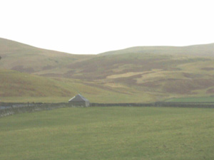
The old route from Crawfordjohn to Leadhills
follows the
line of the road in the picture. It veers to the left
to pass
over to a valley that runs up to Leadhills
Route The route most consistent with the other
routes here would have been Lanark to Crawfordjohn then
Enterkinhead and down the Nith valley to Dumfries. The
route to Crawfordjohn would have been by Crookbait and
Douglas Water (see above). There would have been no
need to have gone into Douglas and Roy shows a route
following the A74 line as far as Mid Rig (NS8627) and
then by a present day track to Crawfordjohn. This shorter
route than that through Douglas would help to account
for some of the discrepancy in mileages (Douglas - Dumfries
26 plus Douglas - Lanark 8 giving 34 miles rather than
the 32 of the present route). The route, for geographical
reasons as well as being shown on Roy, would then have
followed the present day minor road to Leadhills and
Wanlockhead. From here a still existing old track runs
south to Carronbridge and ultimately Dumfries. See Inglis
for an interesting account of the Enterkin.
Evidence Included in lists of distances. As for
Lanark - Douglas route. Joining the known route from
Leadhills to Biggar (see T
Reid).
Dumfries - Glasgow
56
Route The mileage is 10 miles more than the routes
below for Glasgow - Douglas Castle 20 and Douglas -
Dumfries 26 which total 46. Although Glasgow - Dumfries
via Douglas would be a viable route we cannot say it
is the one referred to.
Evidence Uncertain
Lanark - Peebles 16
Route The mileage is consistent with a route
through Biggar (Lanark - Biggar 4 miles; Biggar - Peebles
12 miles although another item in the list (see below)
has 10 miles). This would give the route as Lanark -
Symington - Biggar - Broughton - Drumelzier - Peebles.
Evidence As already noted for individual sections
of the route.
Hamilton - Peebles
24 (via Lanark 8 + 16)
Route The mileage is consistent with the Hamilton
- Lanark route (8 miles) and Lanark - Peebles (16
miles). The route would then have been via Crossford
and the Mouse Water to Lanark then to Biggar, Broughton,
Drumelzier and Peebles.
Evidence As already noted for individual sections
of this route.
Glasgow - Douglas
Castle 20
Route The route would have been as that for Glasgow
- Hamilton and then out to Larkhall (Hamilton -
Lanark route). From here Roy shows a road on the A74
line to Blackwood and then by a minor road to Craighead
where Pont has a crossing. From here Roy’s route skirted
Broken Cross Muir by a still existing track then headed
past Cairnhouses and Poneil to Douglas Castle.
Evidence Included in lists of distances. As for
Glasgow - Hamilton and Larkhall. Beyond this point there
is the Pont crossing at Craighead, a Spittal
close to the route, as well as the suggestiveness of
Roy’s route including it’s having led to Douglas Castle.
A Nether
and Over Brigtoun north of Douglas may also be associated
with this route.
Glasgow - Falkirk
18
See section on quote
"The hie way fra Edinburgh to Glasgow is throw Falkirk".
Peebles - Biggar
10 (another has 12 miles)
Route As noted above the route
was probably through Broughton and Drumelzier although
this route is stated to be two miles shorter.
Douglas Castle - Lanark 4
See entry above. Note the
difference in the distance.
Douglas - Dumfries
26

Leaving Crawfordjohn for Douglas. This
access road
eventually becomes a hill track
The distances in the entry immediately below total 26
miles, so presumably indicate the route.
Douglas - Crawfordjohn 4, Enterkinhead 6, Dumfries 16
Route As well as a route shown on Roy which runs
almost directly between Douglas and Crawfordjohn (it
passes near the summit of Pagie Hill) the route would
be as that already given for Dumfries to Lanark, i.e.
Leadhills, Wanlockhead, Enterkinhead, Carronbridge etc.
Douglas - Kirkcudbright
40
Again the distances in the entry immediately below total
40 miles, so must indicate the route.
Douglas - St John’s Clachan (St John’s Town of Dalry)
22 St John’s Clachan - Kirkcudbright 18
This will be dealt with under the Nithsdale sheet.
Back to previous
page
Top
|
