|
30 December 2014
Medieval Roads - West
Lothian
Charters for Newbattle Abbey in East, Mid and West Lothian
30 September 2014
Medieval Roads - East
Lothian: additional charters. See under Yester
Writs mostly
relating to Cistercian convent of Haddington
with roads mainly in
parishes of Haddington, Gifford, Garvald & Bara,
Morham.
21 July 2014
Newsletter No.19
1 July 2014
Medieval Roads - Fife:
additional charters - Markinch, Lundin, Dairsie, Kedlock,
Crail, Granges, Mottray Water, Forgan, Kinnear, Kirkcaldy
area, Pilgrimsgath, Guardbridge, Dairsie Bridge, Kirkden
(Angus)
20 May 2014
Mediaeval
Roads - Fife: charters for St Andrews Cathedral
Priory
1 April 2014
Medieval Roads: Evidence from Charters - Fife.
Charters for Priory of Isle of May for lands in East
Lothian (Garvald & Bara and Whittinghame parishes)
26 February 2014
Newsletter No.18
4 February 2014
Mediaeval Roads: Evidence from Charters - Fife.
Additional charters for Balmerino Abbey.
17 December 2013
Mediaeval Roads: Evidence
from Charters - Fife. Dunfermline
charters added. Some of these are for places in Stirlingshire,
Perthshire, Mid Lothian and East Lothian.
22 October 2013
Mediaeval Roads: Evidence from Charters - Fife.
Some charters from Inchcolm abbey.
2 September 2013
Newsletter No.17
20 August 2013
Mediaeval Roads: Evidence from Charters - Perthshire.
Charters from Coupar Angus, Inchaffray and Scone abbeys.
25 June 2013
Mediaeval Roads: Evidence from
Charters - Perthshire.
Charters from Coupar Angus abbey.
16 April 2013
Newsletter No.16
26 March 2013
Mediaeval Roads: Evidence from Charters - Aberdeenshire.
Fyvie castle and New Machar.
Mediaeval Roads: Evidence from Charters - Forfar
& Kincardineshire - Arbroath abbey charters.
5 February 2013
A note about the Road of the Bowmen (Statistical
Accounts, Banff, Grange and Mediaeval
Roads, Moray, Strathisla) added, viz. Note: Cosmo
Innes notes in his Lectures on Scotch Legal Antiquities,
p.266,
that a Bowman was a person hired to look after a tenant's
milk cows and their pastures. The road probably indicates
a route to these pastures rather than, as said, the
route taken by the bowmen in a battle with the Danes.
Mediaeval Roads: Evidence from Charters -
Dumbarton (one charter
for Kirkintilloch added); Lanark
(one addition for Douglas parish); Stirling
& Clackmannan (several charters)
Newsletter No.15
10 December 2012
Statistical
Accounts - Roxburgh, Peebles, Selkirk - links repaired.
Also Stewartry, Dumfries, Berwick, Lothians, Stirling
and Renfrew.
Peebles - Broughton
parish: Notes from Rev. Andrew Baird's "Annals
of a Tweeddale Parish"
5 November 2012
Mediaeval Roads: Evidence from Charters - Forfar
& Kincardineshire.
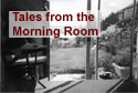 Tales
from the Morning Room Tales
from the Morning Room
Nothing to do with the history of roads - just some
bits and pieces of writing.
16 October 2012
Roman Roads - Dere
Street
14 July 2012
Newsletter No.14
22 May 2012
Mediaeval Roads: Evidence from Charters - Aberdeenshire.
Mounth passes and two new charters for Ellon parish
and two for Tarves parish.
Resources/Journals - Berwickshire
Naturalists Club
28 February 2012
Newsletter No.13
New section started on Romans.
For the time being it will be filed under Miscellaneous
but will eventually be a section on its own.
7 February 2012
1878 List of Highways - Stewarton
6 December 2011
Mediaeval Roads: Evidence from Charters - Aberdeenshire
22 September 2011
Roads by County
- link to NLS collection of town and county directories
added. These can contain useful information on roads,
coaches, carriers etc in the 19th and early 20th centuries.
7 September 2011
Mediaeval Roads: Evidence from Charters - Moray.
Some additional charters for Inverness and Nairn.
Includes a link to James Robertson's map showing the
supposed Roman road from Braemar to Forres via Cromdale.
Newsletter No.12
19 July 2011
Mediaeval Roads: Evidence from Charters - Moray
3 May 2011
Military Roads:
The Caulfeild Roads
Newsletter No.11
15 February 2011
Statistical Accounts - Argyllshire;
Perthshire.
This section is now complete but will be revisited from
time to time to add images etc.
Newsletter No.10
16 November
2010
Statistical Accounts - Kincardine;
Forfar
Road by County:
Agricultural Reports - links to sections on roads
in these reports dating from around 1800
13 September 2010
Statistical Accounts - Elgin;
Nairn
Some photos/maps added to Statistical Accounts for Banff
and Inverness
Newsletter No.9
3 August 2010
Statistical Accounts - Aberdeenshire
Some photos added to Statistical Accounts - Berwickshire
and some links repaired.
21 June 2010
Statistical Accounts - Inverness;
Banff
County Overviews (Cambridge Geographies) - Ross
& Cromarty
Newsletter No.8
3 May 2010
Statistical Accounts - Sutherland;
Ross & Cromarty
8 April 2010
Statistical Accounts - Orkney
& Shetland
Links repaired for Roads
in Counties 1859
4 March 2010
Statistical Accounts - Buteshire
Newsletter No.7
February 2010
Mediaeval Roads: Evidence from Charters - Fife.
Charters for Collessie added.
8 January 2010
The Military Roads
- at present this deals with Wade. Further material
on the Caulfeild roads and on the Portpatrick road will
be added in due course.
15 December 2009
Newsletter No.6
26 November 2009
Statistical Accounts - Fifeshire
25 October 2009
Statistical Accounts - Clackmannanshire
and Kinrossshire
15 October 2009
Newsletter No.5
8 October 2009
Roads and Tracks of Ayrshire: Mediaeval Roads -
additional
material
11 September 2009
Some photos added. See in particular photos from
c.1900 from the Detroit Publishing Company - thumbnails
on Library of Congress site.
Roads and Tracks of Ayrshire - new section: Turnpike
and Statute Labour Roads in 1859
11 August 2009
Newsletter No.4
24 July 2009
Coaching
Days - some sites dealing with life on the roads
in the stagecoach era - includes post-horn calls.
17 July 2009
Mediaeval Roads: Evidence from
Charters - more charters for Roxburghshire
added -
Bowden, Lessudden, Melrose parishes
9 June 2009
Newsletter No.3
Mediaeval Roads: Evidence from Charters - more charters
for Roxburghshire
added
Mediaeval Roads: Evidence from Charters - more charters
for East Lothian
added
24 May 2009
Resources on Old Scottish Roads - page added on
Leisure and Heritage
Paths - these are links to sites dealing with walking
and cycling routes, some with historical information
4 May 2009
Mediaeval Roads: Evidence from Charters - some charters
for Roxburghshire
added
10 April 2009
Mediaeval Roads: Evidence from
Charters - some charters for Renfrewshire
added
Newsletter No.2 - this will now
be done every two months
27 March 2009
The Toll Points of Ayr and Rutherglen: Implications
for Routes
Statistical Accounts for
Renfrewshire
3 March 2009
Monthly newsletter started
25 February
2009
References
to Roads in Walter MacFarlane's Geographical Collections
1 February 2009
Overview map for
mediaeval roads
Points of interest added to Statistical
Accounts pages
References to
Roads in Chalmer's Caledonia
9 January 2009
New home page - other pages will be altered in due course.
The Taylor & Skinner road atlas which previously appeared
here can be found on the Scribd
site.
30 December 2008
Mediaeval Roads: Evidence from Charters - some charters
for Kirkcudbrightshire
added
10 December 2008
Statistical Account for
Stirlingshire - NSA summaries added
2nd December 2008
Mediaeval Roads: Evidence
from Charters - some charters added for East Lothian,
Mid Lothian and Fife -also a charter in East Gordon
in Berwickshire
16th November 2008
Statistical Account for
Dumbartonshire - summaries added for NSA
9th November 2008
Mediaeval Roads: Evidence from Charters - Berwickshire.
Some charters of Kelso Abbey relating to Berwickshire
29th October 2008
Roads by County now has two pages - County
Overviews which are summaries of entries on roads
that appeared in the county volumes of the Cambridge
County Geographies published in the early 1900's; and
Links and
Resources which was the original page for this section
19th October 2008
Statistical Accounts - OSA summaries for Stirlingshire
and Dunbartonshire
10th October 2008
Statistical Accounts
- NSA summaries added for Dumfriesshire
19th September 2008
Two charters added to Mediaeval Roads: Evidence from
Charters - Peeblesshire.
One refers to the "high road of the Carnes",
later known as the Cauldstane Slap.
29th August 2008
Additional material for Dunbarton and Lanarkshire added
to Mediaeval Roads: Evidence
from Charters
5th August 2008
Miscellaneous - new
section on mediaeval roads started
3rd July 2008
Roads in the 1600's -
pages added for Eskdale, Lauderdale, Liddesdale, Teviotdale
and Tweeddale. Additional information on Berwickshire
page.
26th May 2008
Statistical Accounts
- NSA added to Kirkcudbright and Wigtonshire
20th May 2008
New Miscellaneous section
added. This will contain short articles. Currently has
items on a road between Newbattle Abbey and the Monklands
and an old road between Ayr and Kirkcudbright.
25th April 2008
Military Survey
of Scotland - a list of roads that do not
appear to have been mapped
16th April 2008
Discovery & Excavation
in Scotland - indexes for road-related items 1947-1989
with links to original texts on ADS site
15th March 2008
Statistical Accounts
- OSA/NSA for East, West & Mid Lothian added
29th February 2008
Statistical Accounts
- NSA summary added to Lanark
24th February 2008
1. New section added -
Historical Overview
2. Page added for Transactions
of the Hawick Archaeological Society
3. Resources>other
countries - additional links for roads in
Finland and Latvia
14th February 2008
1. Statistical
Accounts - NSA summaries added to Berwick, Peebles
and Roxburgh
2. Resources>other
countries - additional links
31st January 2008
Resources on Old Scottish Roads
- additional resources annotated
20th January 2008
Old Statistical Account
for Peeblesshire added, with links to NSA
17th January 2008
Old Statistical Account
for Roxburghshire added, with links to NSA
9th January 2008
Old Statistical Account
for Berwickshire added, with links to NSA.
Link to online copy of Cuninghame
Topgraphised by Timothy Pont.
20th December 2007
Old and New Statistical
Accounts for Selkirkshire added.
13th December 2007
1. OSA for Dumfriesshire
added, with links to NSA.
3rd December 2007
1. The Military Survey
of Scotland
Quarter-inch map for Borders added.
26th November 2007
1. Various links leading to Report
of the Commission for Highland Road and Bridges on
Am Baile website. This gives the Reports from 1802 to
1856. See also links to Slaters Directory for 1911 on
Highland counties - these entries have some details
of roads at that time.
22nd November 2007
1. The Military Survey
of Scotland
Half-inch map for Edinburgh and Lanark added.
Note: if the high definition map for this and the
other half-inch maps do not load properly try refreshing
browser or reloading a couple of times.
2. Separate page for Transactions
of the Gaelic Society of Inverness.
19th November 2007
1. Links
to sites in other countries.
2. New section Roads
by County. This has no new material but brings material
relating to an individual county into one place for
easy reference.
8th November 2007
1. Roads in the 1600s
Roads added for Berwickshire, Lothians and Linlithgow
and Stirlingshire sheets. Placenames and river crossings
have still to be completed for these areas.
5th November 2007
1. Roads in 1859
Maps added for most counties.
19th October 2007
1. The Military Survey
of Scotland
Regional overviews for Glasgow and Greenock areas added.
Half-inch map for North Berwick, Berwick upon Tweed
and Selkirk added.
11th October 2007
1. Roads in 1859
New section on Report of the Commissioners for Inquiring
into Matters relating to Public Roads in Scotland, 1859
25th September 2007
1. List of Resources on
Old Scottish Roads
|